A pair of moderately sized earthquakes were measured off the coast of British Columbia on Wednesday.
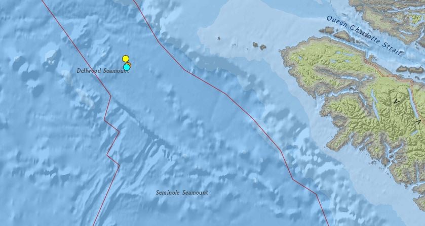
The first was measured at magnitude-4.1 at 2:53 p.m. PT just over 100 kilometres west of the northwest tip of Vancouver Island.
The second came nearly two hours later at 4:34 p.m. PT and was measured in almost the exact same spot, coming in at magnitude-4.8 on the Richter scale.
Both tremors were measured at a depth of 10 km and didn’t pose a tsunami threat to any island communities.
Wednesday’s incidents come just three days after a magnitude-4.2 earthquake was measured in the same area.
Sunday’s earthquake was also measured at a depth of 10 km.
The biggest earthquake in B.C. history was a magnitude-8.1 tremor in the Queen Charlotte Islands in 1949.
In recent years, it was a magnitude-7.8 earthquake that hit Haida Gwaii in October of 2012.


