It may mean a slightly later start to the ski season, but it’s hard to complain about milder temperatures as we head towards winter.
The Weather Network released its fall 2018 forecast today and while you can take extremely long-term forecasts with a grain of salts, it looks like a “warmer” and “mild” fall can be expected.
That’s not just for B.C. either, as most of Canada looks like it’ll be at or above seasonal temperatures for much for the next three months.

“Most Canadians can expect a mild fall with near normal or above normal temperatures for nearly all of Canada except for parts of Nunavut, northern Quebec and Labrador,” reads the Weather Network’s report.
“The warmest weather relative to normal is expected from the Martimes to Southern Ontario and across the far western side of the country including B.C., parts of Alberta and the Yukon.”
Chief meteorologist Chris Scott says there will be a less active and less tumultuous weather pattern than normal this year, meaning less wild temperature swings and powerful fall storms.
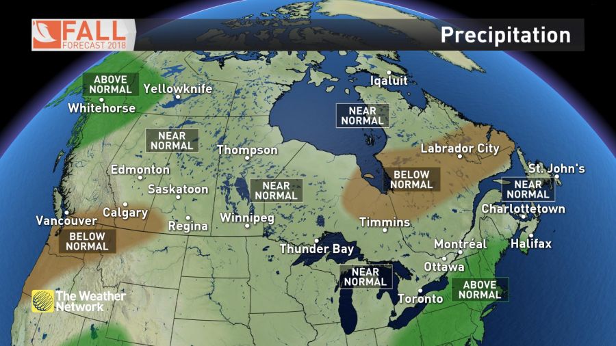
For B.C. specifically, the northern half of the province should expect some serious precipitation during the fall, but the southern half will see a “drier than normal” season, at least to start.
“A wetter pattern during late fall should bring most of the south coast to near normal for the season,” the report explains.
So while it may be a late start to the ski season, it should still be a great one!


